Places We Have Called Home In 2020
Home Is Where We Park It – Fort Beale RV Park, Kingman, Arizona
May 21, 2020
Temperature 74 Degrees
Arizona Route 66 Museum at The Powerhouse Visitor Center
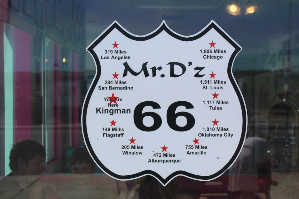
Mr. D’s for Lunch
Even as a fish needs water, so Barbara and I need to go sightseeing. So, today was the day to get back to doing what we love to do.
We had a great breakfast to start the day. I had a delicious cheese and mushroom omelet with a side of fired spam. I added a glass of juice and a couple cups of coffee. Barbara had a plate of scrambled eggs and coffee. Tummies full we were now ready to get back to doing what we love to do – sightseeing.
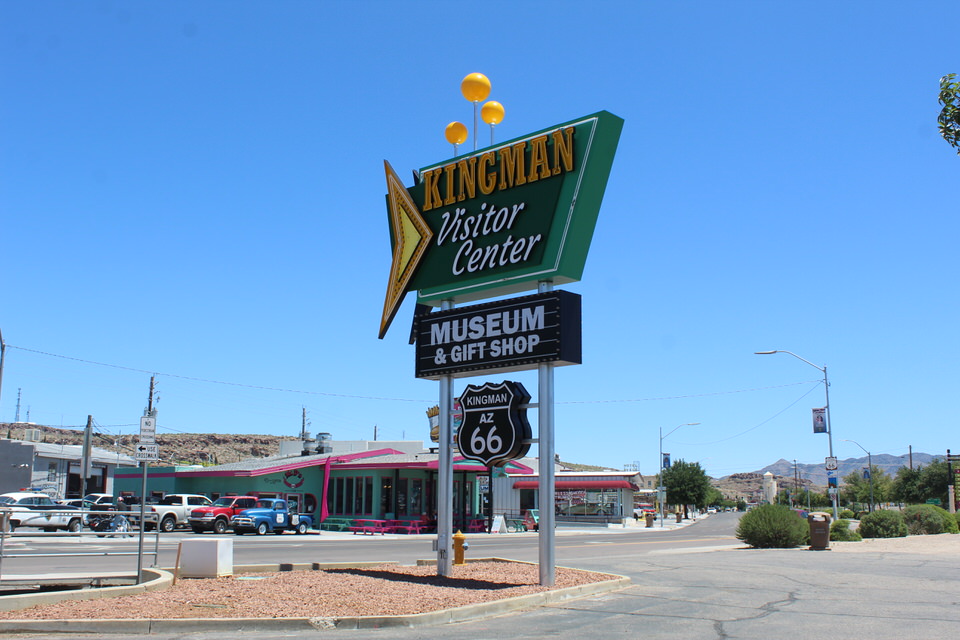
We were off to the Kingman Visitor Center and the Arizona Route 66 Museum located in the

Refurbished Desert Power and Water Company Building.

Today it is listed on The National Register of Historic Places.


Let’s get going because a world of discovery is waiting for us inside these doors.

Before we go in, though, when was the last time you saw one of these? It’s all in one piece, it works and there is no graffiti anywhere on it, Amazing
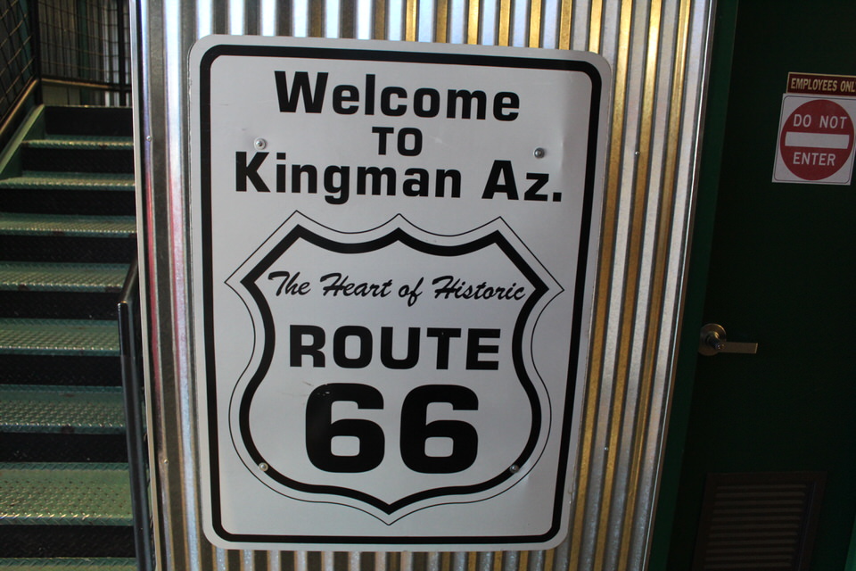

Our goal today was the Arizona Route 66 Museum. We’re here to learn a bit more about Route 66, its history, the good days, and what brought about its end.

Long before U.S. Route 66 carried travelers back and forth Native American tribes created the first roads. Well worn footpaths served as trade routes linking the current day Arizona area to the Pacific Ocean.

Fr. Garces is believed to be the first European to have traveled these native trade routes and left a detailed account of his life in this unknown land. Today, the area surrounding these early trade routes is known as the 35th parallel route denoting a measure of latitude which passes through northern Arizona. This route has historically served as the foundation for east/west travel and eventually became the southwestern portion of the U.S. Route 66.

In 1851 Captain Lorenzo Sitgreaves provided the first technical mapping of the region. His many months of research concluded with a practical recommendation for building a road along the 35th parallel rather than along other existing trails in the West.
In 1857 a contract was awarded to former Navy Lieutenant Edward F. Beale to survey and develop such a route. Beale and his team began their mission from Fort Defiance, New Mexico Territory and on the 49th day of their journey they reached the Colorado River.

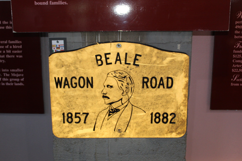
The result of this expedition was the Beale Wagon Road, the first federally funded wagon road in America.
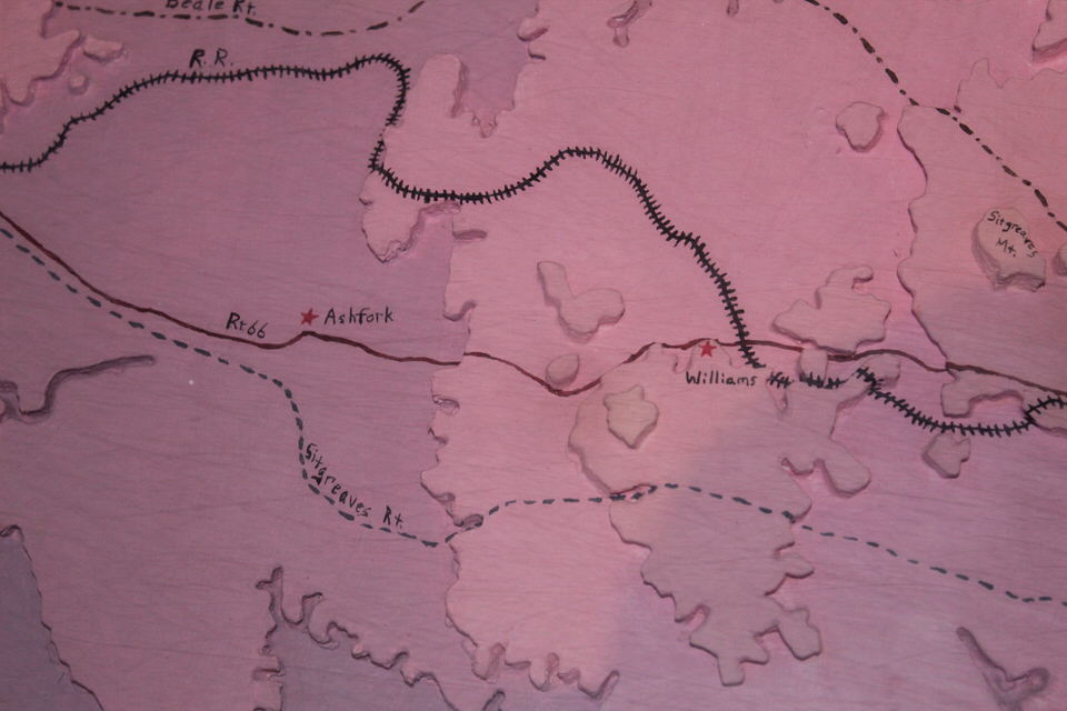
Now knowing that when we leave here we are headed east through Williams this part of the topographic map was of particular interest to me. I was especially interested in the route between Ashfork and Williams. Yup, definitely will have some more mountains to climb!


Just months after Beale’s team had completed their work, travelers were already eager to use this new, improved route called the Beale Wagon Road. The covered wagons used by the overland pioneers were often called prairie schooners.
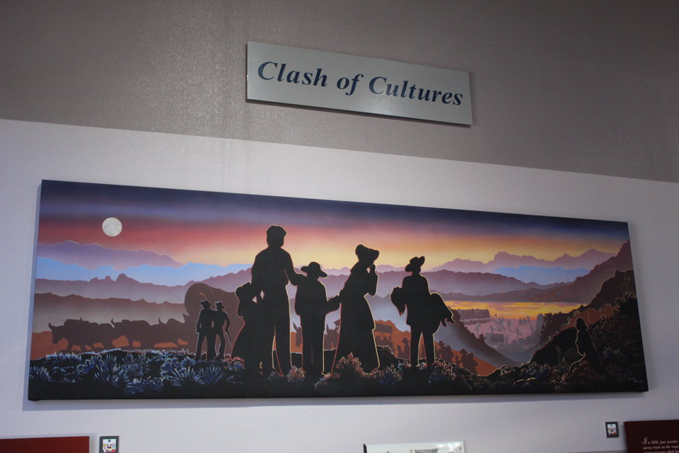
Conflicts with Native Americans were also common, as the trickle of settlers became a steady stream through native lands.
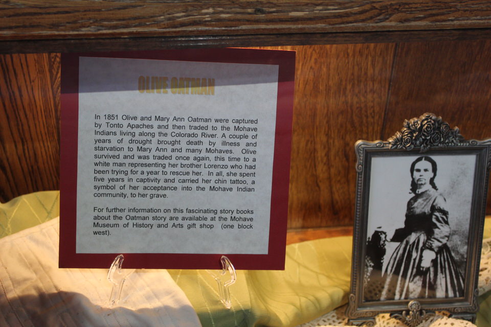
The capture of Olive Oatman.

The Rose Massacre. News of this massacre ignited fear and outrage in the U.S. New measures needed to be taken to protect settlers moving west. In 1859, Fort Mojave was established on the Colorado River and proved to be a successful strategy for sheltering and protecting fearful travelers.

In time the early settlers prairie schooners were replaced by the automobile. This in turn necessitated the need for even better roads.

Look closely, just above the running board, note what is at the end of the writing Shortest & Best Route – then read below
I was dumbfounded when I read this.

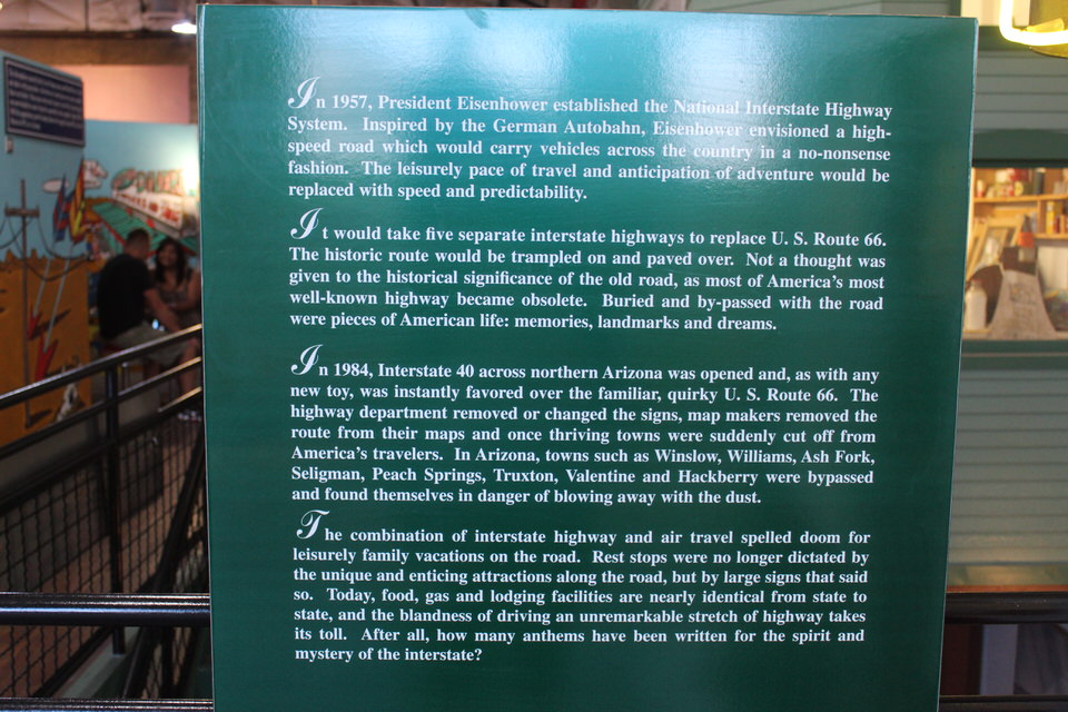
Over time Route 66 continued to grow and evolve.

Finally, in 1938 it was paved from Chicago to Los Angeles.
The Good Times for Route 66 after WW II.


Alas, the good times would soon come to an end.
Well, we’re finished with one part of this fascinating museum.


Of course we had to make a stop at the Gift Shop. Barbara picked up some post cards, a few pamphlets and I
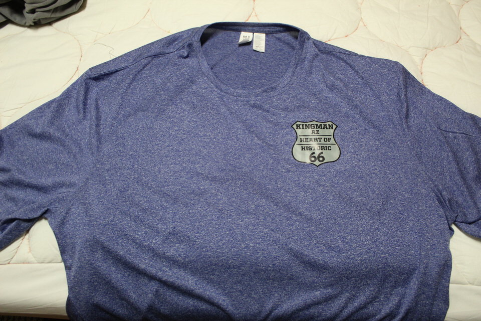
got a new T-shirt after a long drought.
I have more to share with you from this fascinating museum but for now let’s conclude with where we stopped for lunch. Yea, we really got bold and brave and actually went to a Route 66 roadside diner.
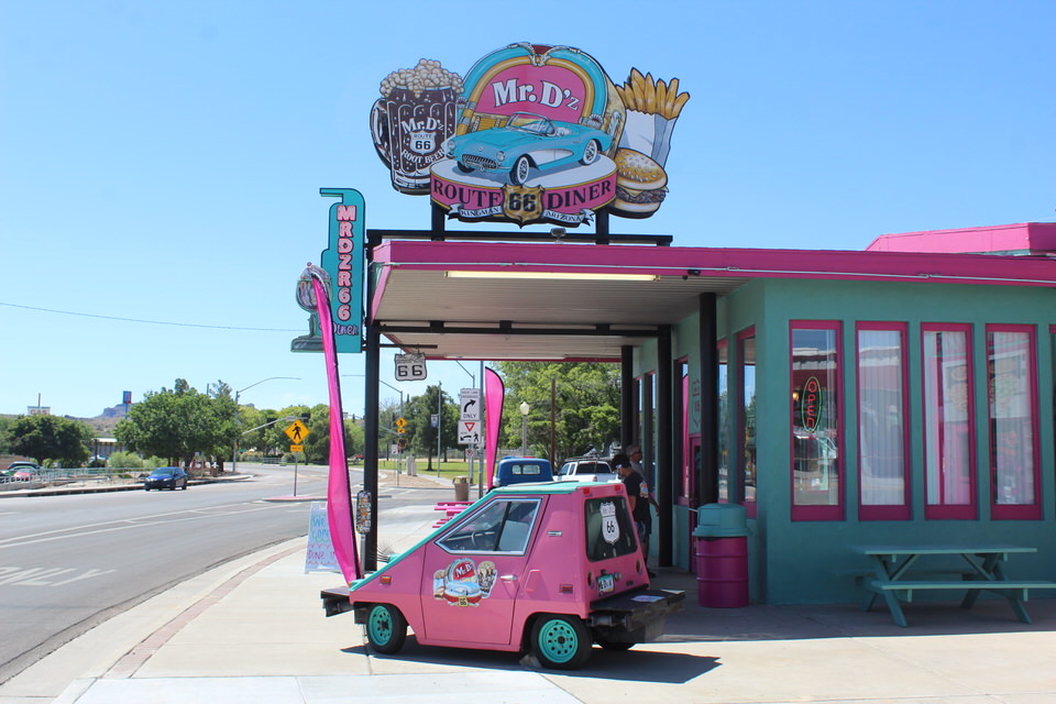
When I discovered that they had home made root beer I had to go.

Their dining room was open.
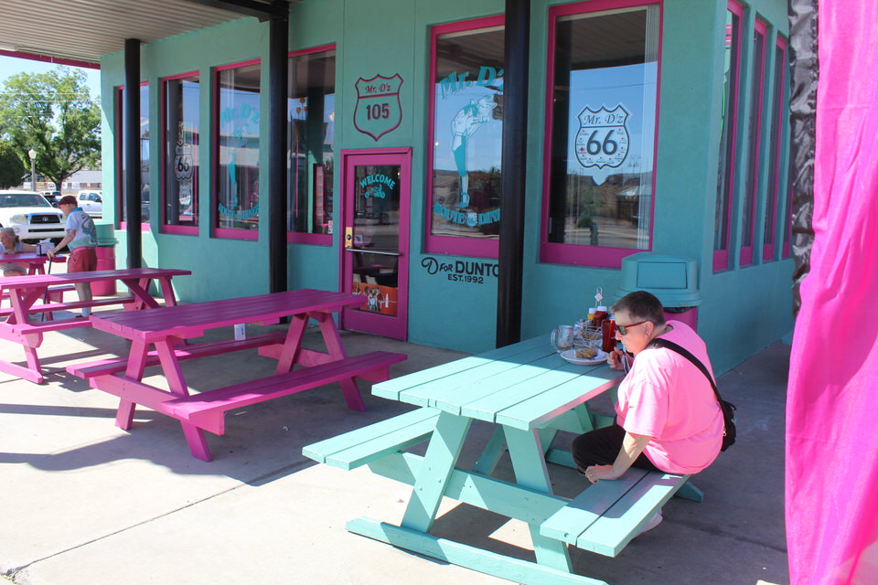
We decided, though, to stay outside and practice social distancing. About the food, it was out of this world. Especially the root beer. We will be back again before we leave this area.
Hey, Winslow – we’re going there. Why? Just to say that we also stood on the corner in Winslow, Arizona.


In the parking lot.

Across the street I discovered this road sign. Where do you want to go?
That brings to an end our day on The Road of Retirement. We actually got to travel a part of historic Route 66. We spent some time discovering its history. We had a fantastic lunch. All in all an absolutely dynamite day.
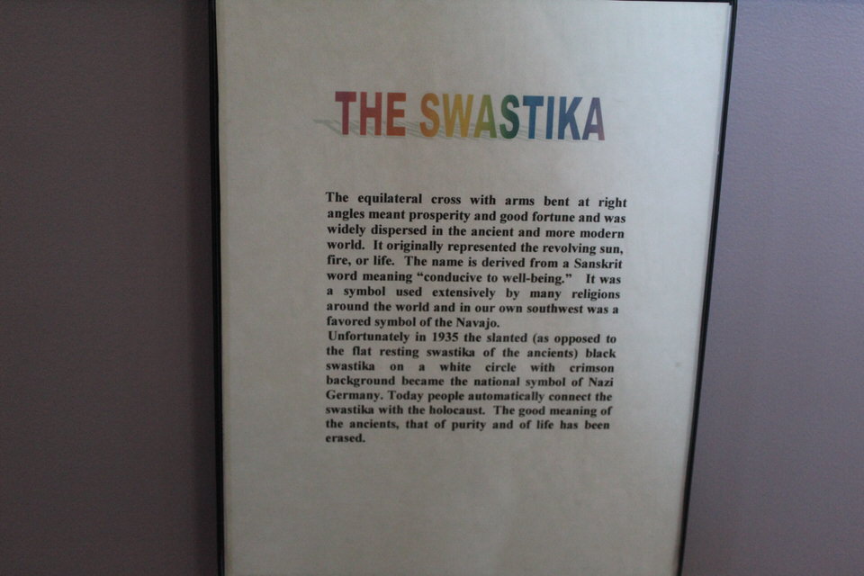
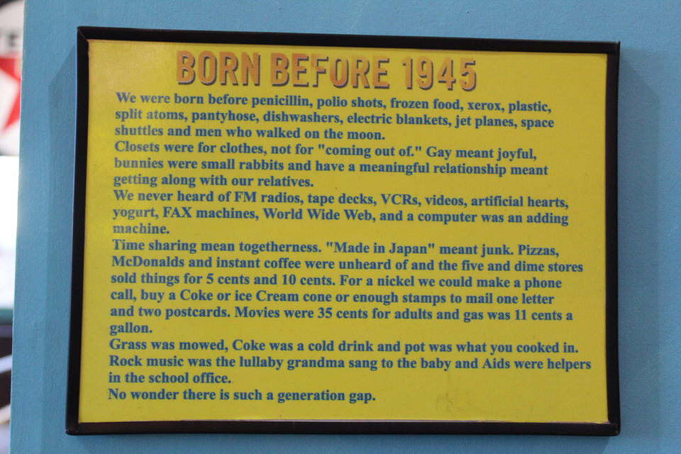
Let me finish with this delightful plaque that I discovered at the museum.
Thanks for joining us today. Hope you had as wonderful a day as we did. Always appreciate your comments. Keep safe. Wear your mask – if not for yourself then for someone else. Remember, six feet apart or you could end up six feet under. Wash your hands often. See you tomorrow.
These are the voyages of Elvira and it’s two intrepid travelers. Our continuing mission: to explore as many new states as possible, to seek out new acquaintances and make new friends, to boldly go where we have never been before.
See you on down the road!

What a great museum! Very interesting about the swastika. It is forever changed. Even seeing it on the old car – knowing its meaning then – still gave me the creeps. Glad you got to do some exploring!
LikeLike
This is what you guys have been looking forward to. Very interesting items and info. I’m a bit behind but will catch up. Enjoy and keep those blogs coming.
LikeLike